Starting from the Central Station (the main railway station),
I walked through Grainger town,
the historic centre which was planned and built in the early/mid 1800s,

 towards the Tyne Bridge,
a beautiful compression arch suspended deck bridge built in the 1920s (photo below),
and Quayside,
the area along the River Tyne which has been the centre of urban regeneration efforts since the 1990s,

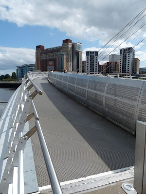
 where I crossed the Millenium Bridge (the white bridge in the distance in the above photo; also in the photo below),
to sit in the sun outside the Baltic, a flour mill beautifully converted into a contemporary art gallery (photos below), and
the Sage (the shiny curvaceous building in the photo above), designed by Norman Foster,
one of those iconic architectural projects
that have been at the centre of controversial urban regeneration efforts
in deindustrialized cities in the West.
Controversial because they spend millions (taxpayers' money) on projects that usually do little (often nothing) to address
the socio-economic problems and massive unemployment caused by deindustrialization.
Newcastle, I must tell you here,
had a thriving coal mining & manufacturing industry
which Thatcher killed in the 1980s.
On my first walk in the city with Steve, he'd told me that many parts of the city used to be grimy, black, during the heydey of its coal mining & manufacturing days.
Maybe that is why my mother remembers Newcastle as a pretty horrible looking city (she'd lived and worked for a year as a physiotherapist near Newcastle in the mid-1960s).
Newcastle was also one of the world's largest ship-building and repairing centres,
of whose history I do not know enough.

 To come back to my walk,
I then walked back over the Millenium Bridge, and away from the river
through an industrial looking area,
to the Byker Wall (seen in the distance in the photo below).
 I spent quite a bit of time roaming about Byker and this calls for a separate blog post, especially since I want to first finish reading some recent academic articles I downloaded on the project before I put up any more photos. Byker, which was built in the mid-1970s, is well-known among the architectural-planning community - it was designed by British architect Ralph Erskine and was a project that involved participatory design, unusual for social/public housing projects in Britain at the time. And yet, Byker has had its share of social problems. This is what I want to read about. So more in a couple of days.
Not only happy and excited to see nice photographs of changed Newcastle and Durham but very pround and amazed about your enthusiasm to explore both places & its surroundings and wonderfully descibing the each photo of your blog.
ReplyDeleteMa